This is a pdf version of the BioScience article (Abell et al. 2008) that describes the Freshwater Ecoregions of the World map and associated fish data.
Legend for Freshwater Ecoregions of the World (536KB)
This is the full list of 426 freshwater ecoregion names. It can be used in combination with the map or image file.
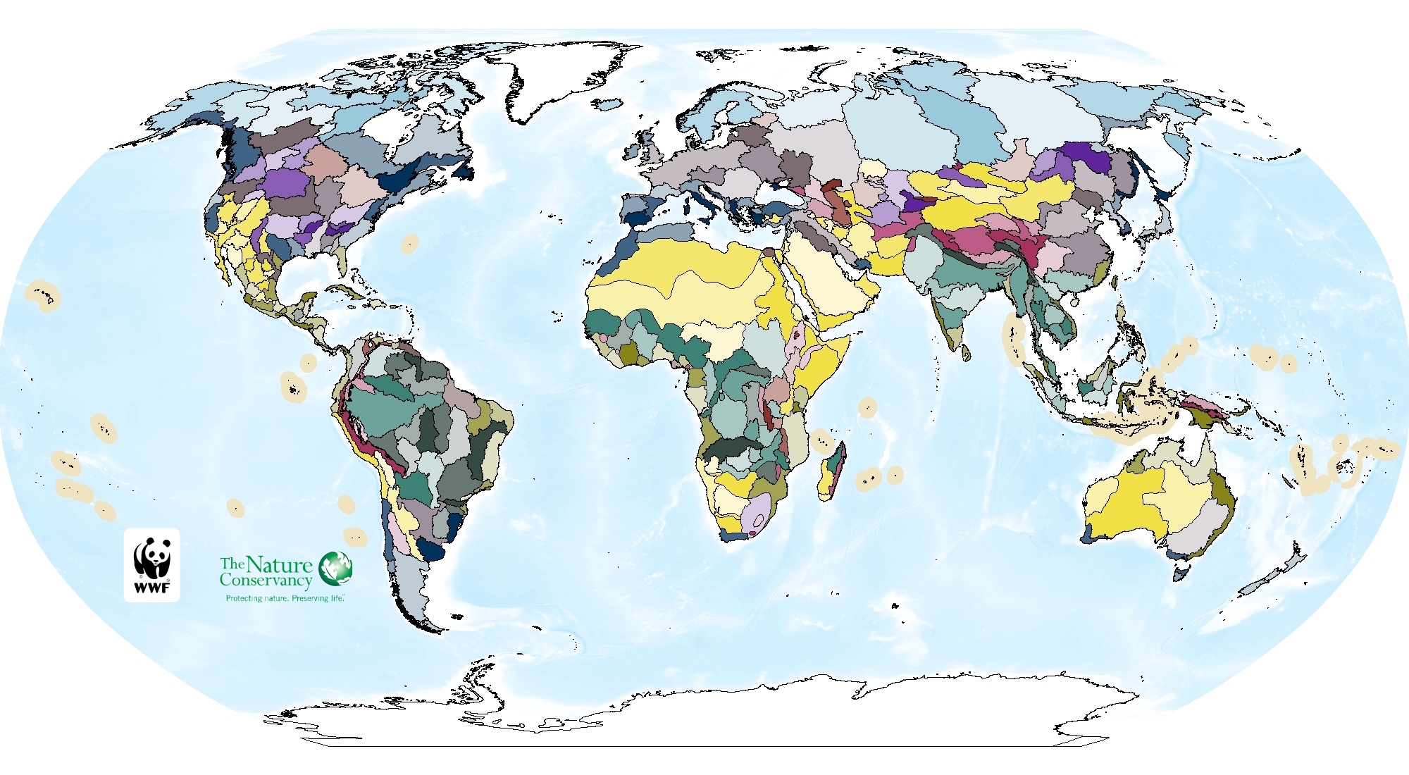
Image of Freshwater Ecoregions of the World (1.2MB)
This is an image of the freshwater ecoregion map. This image can be used in presentations (e.g. Powerpoint) or other documents.
This is the GIS shapefile of the freshwater ecoregions of the world. It is a zipped file and contains metadata. The boundaries of the ecoregions were updated in 2013 to follow HydroBASINS and this version reflects those updates.
Freshwater Ecoregions of the World poster (for online viewing)
This is a PDF (5 MB) of a large-format poster showing the freshwater ecoregion map as well as selected biodiversity and threat maps. This file is for online viewing only.
Freshwater Ecoregions of the World poster (for printing)
This is a medium-resolution PDF (2 MB) of a brochure describing the Freshwater Ecoregions of the World project and outputs.
Freshwater Ecoregions of the World brochure (for online viewing or printing)
This is a medium-resolution PDF (2 MB) of a brochure describing the Freshwater Ecoregions of the World project and outputs.