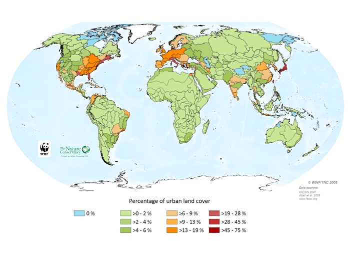
The number of large cities and megacities identifies centers with high human population but it does not provide the spatial extent of urban areas. Lands converted to urban use generally contain large expanses of hardened surfaces as well as extensive water infrastructure, both of which affect natural runoff patterns. Urban runoff also often contains pollutants, which find their way to freshwater ecosystems. Columbia University\'s Centre for International Earth Science Information Network\'s Global Rural Urban Mapping Project (GRUMP) estimates that 3% of the earth\'s non-marine surface is occupied by urban areas, and these areas are more agglomerated than is normally evident when settlements are represented merely as points on a map. The GRUMP dataset identifies the extent of human settlements with a population over 5,000 globally and classifies these as urban areas. The GRUMP dataset incorporates multiple other datasets ranging from national statistics to remotely sensed data.
Urban land cover