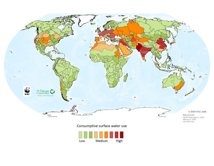
This map
of the average annual amount of surface water used in each ecoregion gives an
indication both of water resources development and of the potential impact of
water consumption on freshwater ecosystems. The data used to calculate water
use are from WaterGAP,
a global hydrologic model developed by the University of Kassel in Germany. The
model only considers water that is withdrawn from surface water systems, and
considers four water use sectors: industrial, domestic, livestock, and
irrigation. For this analysis, all sectors have been combined. Water use
analysis shows where human development has concentrated its water use, or where
surface water resources are most exploited. Due to limited data
availability, groundwater use and non-consumptive water use (like storage in
reservoirs, hydropower, or pollution) are not considered, even though these put
additional stress on water resources. The results form an essential input to
the ‘surface water abstraction stress to rivers’ map, also found on this
website.